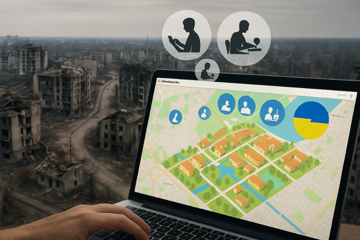
In an age where fast and accurate information is crucial, the use of digital mapping tools in Ukraine demonstrates how technology can aid in the rebuilding of devastated communities. Especially for social media users, content creators, and businesses involved in relief and awareness campaigns, these tools serve as bridges to accelerate action and planning. With the help of modern technology, assistance and recovery become more systematic and within reach.
Overview: Digital Mapping Tools for Rebuilding Ukraine
- Digital mapping tools help Ukraine identify and repair damaged areas
- They serve as guides for humanitarian efforts and infrastructure planning
- They provide real-time information for faster and more accurate decision-making
- International aid and technology play a major role in their successful implementation
History and Importance of Digital Mapping Tools During Crisis in Ukraine
In the early days of the invasion of Ukraine, the importance of real-time information became immediately apparent. With the help of digital mapping tools, local and international organizations were able to document destroyed buildings, burned homes, and displaced communities. There was no need to rely on outdated maps or physical surveys. With just a few clicks, critical areas needing urgent response could be identified.
For example, volunteers from around the world used OpenStreetMap to repair and update maps of affected areas. From Lviv to Mariupol, each update enabled disaster response teams to deliver aid more efficiently.
Beyond emergency response, digital mapping tools also served as historical records of Ukraine’s damage and recovery. Each photo and map update gave the world a clearer understanding of the war’s impact. These maps aren’t just for immediate action—they also serve as evidence for future investigations and planning a more resilient future.
How Digital Mapping Tools Helps Rebuild Damaged Communities in Ukraine
Digital mapping isn’t just for times of crisis. During recovery, its usefulness grows. Through satellite imagery and drone footage, experts can closely examine collapsed buildings and roads that need repair.
A good example is the city of Irpin. After suffering severe damage, digital mapping tools were used to assess which facilities could be repaired and which needed to be rebuilt from scratch. Schools, health centers, and bridges were reconstructed based on the local government’s plans, supported by detailed maps.
This leads to more efficient use of time and funds. Instead of estimating, every step of reconstruction has a concrete basis. Additionally, local stakeholders and engineers can collaborate using shared digital platforms, enabling faster decision-making and minimizing duplication of efforts.
Moreover, digital maps allow urban planners to integrate resilience features into community designs, such as optimized road layouts for emergency access, strategically located evacuation centers, and improved drainage systems to reduce flood risk. This data-driven approach not only speeds up rebuilding but also strengthens the long-term safety and livability of affected communities.
Humanitarian Efforts Empowered by Mapping
Digital mapping tools don’t just help infrastructure—they’re a game changer in humanitarian aid. With detailed maps, it’s easy to pinpoint areas lacking food, water, or medicine. Where once thorough visits were needed, it’s now possible to view evacuation centers and their occupancy online.
Aid delivery methods have also changed significantly. Some NGOs use digital maps to find safe routes to remote areas. This has made aid delivery faster and safer. In some cases, residents themselves provide updates through mobile apps, helping to build more accurate maps.
In addition to identifying needs faster, coordination between organizations has also improved. Centralized mapping platforms make it easier to plan supply chains and aid distribution. These maps serve as communication hubs, showing which group is assigned to which area, preventing overlapping resources, and ensuring no community is left out.
Modern Tools and Innovations in Use
Technology continues to evolve, and so do digital mapping methods. Drones are especially helpful, providing real-time images of areas too dangerous to enter. Artificial intelligence (AI) is also used to speed up data analysis from satellite and drone imagery.
Some mapping platforms are public. One of the most well-known is OpenStreetMap, where anyone with internet access can help update maps. Volunteers from the Philippines, for example, help identify buildings and roads in Ukraine using only satellite images and open-source tools.
The combination of AI, crowd-sourced data, and satellite imagery gives a near-live picture of the situation on the ground. This doesn’t just aid professional planners and humanitarian groups—it allows ordinary citizens to actively contribute to Ukraine’s recovery. By editing maps or submitting data via mobile phones, each contribution helps make the overall map more accurate and useful for affected areas.
Challenges in Implementation and Maintenance
Of course, nothing is perfect. One major challenge is limited internet access and modern technology in some parts of Ukraine. Without a stable connection, it’s hard to update data in real time. At times, information sources can’t be immediately trusted, so thorough verification is needed.
Privacy and security are also concerns. Not all map details can be made public, especially if they might be exploited by hostile forces. That’s why some parts of the digital maps are restricted or filtered before becoming publicly available.
Another major challenge is the capacity of local officials. Not all of them are trained in using digital mapping tools. That’s why part of international aid includes training locals so they can manage and maintain these systems themselves.
The Role of the Global Community and Cooperation
Ukraine can’t do all this alone. International cooperation plays a vital role. Technical experts from various countries travel to help plan and teach how to use digital mapping tools effectively, providing essential training to local authorities, engineers, and humanitarian workers. Universities and research centers contribute by offering free access to their geographic data, analytical tools, and research outputs to accelerate the building and updating of maps.
A notable example is Ukraine’s collaboration with companies like Esri, which provides Geographic Information Systems (GIS) software. With their technology, it’s easier to track projects, identify risk zones, plan long-term development, and even simulate different disaster scenarios to improve future preparedness. Other tech companies, such as Maxar Technologies, have also donated high-resolution satellite imagery that greatly enhances mapping accuracy.
In addition, many international humanitarian organizations, including the United Nations and the Red Cross, have adopted shared digital platforms that allow seamless coordination across borders. These platforms ensure that aid distribution, infrastructure rebuilding, and community support are managed efficiently and avoid redundancy.
The success of digital mapping tools is the result of a united effort between the government, NGOs, tech companies, academic institutions, and everyday volunteers from around the world. Their combined expertise, resources, and dedication continue to play a crucial role in Ukraine’s recovery and long-term resilience planning.
Planning for a More Resilient Future in Ukraine
As Ukraine continues its recovery, it’s also looking ahead. Digital mapping tools aren’t just temporary solutions. They’re being used to design more disaster-resilient cities, whether from floods, earthquakes, or other crises.
Destroyed areas aren’t just being rebuilt—they’re being redesigned to be stronger and better. New urban planning projects are now based on data collected from mapping tools. Authorities assess where to place green spaces, evacuation centers, and public facilities. They also include historical preservation for damaged cultural sites.
As Ukraine uses digital mapping in the present, they’re ensuring it becomes a part of their long-term strategy. With every map update, they take one step closer to recovery and a new beginning.